| File information | |||
| Album name: | mitko / Northeast coast of US | ||
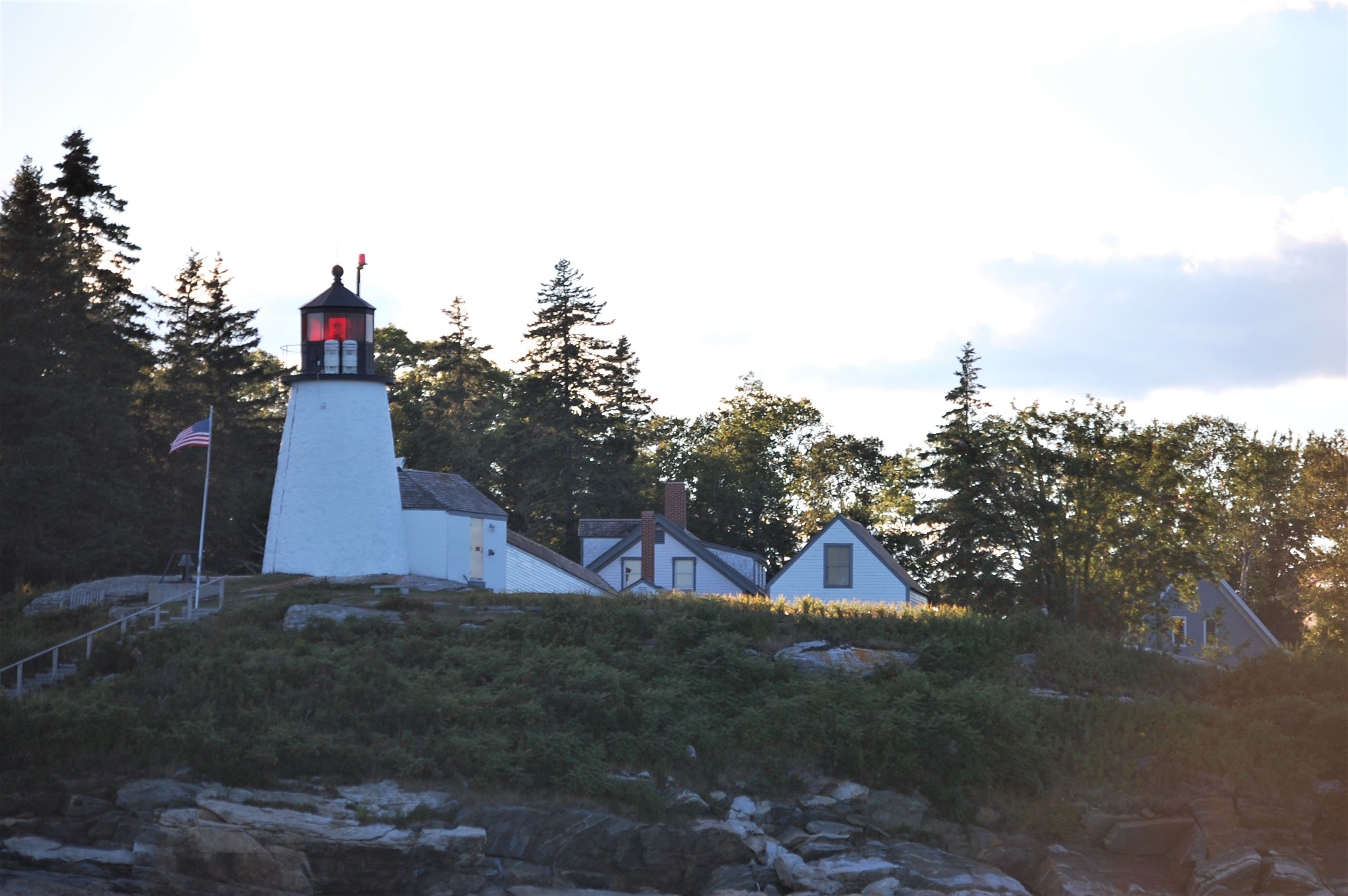
| Current status (active, not active, museum etc): | Active | ||
| Construction details (year of built, shape etc): | 1821 | ||
| Focal plane elevation above sea level, m: | 18 | ||
| Light Description (light sectors, colour of the light, number of flashes etc): | Flashing, 6s, flash 0.6s, eclipse 5.4s, 307-316 white, 316-355 red, 355-8 white, 8-307 red | ||
| Range, nm: | white 8 nm, red 6 nm | ||
| Any other comments: | Covers fairways. Emergency light. Horn(1)10.00s. | ||
| Coordinates (in any format): | 43.825053,-69.640175 | ||
| Displayed: | 5 times | ||
| Date added: | Aug 13, 2020 | ||
| DateTime Original: | 2007:09:01 18:16:04 | ||
| Keywords: | Maine ; United States ; Atlantic ocean | ||
| BBCode: | |||
| Download Link: | Open picture in new window | ||


|
from JC’s Naval, Maritime and Military News https://ift.tt/3gzx79b
via IFTTT
Discover more from JCs Royal New Zealand Navy Ships and New Zealand Defence, Also other World Defence Updates
Subscribe to get the latest posts sent to your email.

