| File information |
| Album name: |
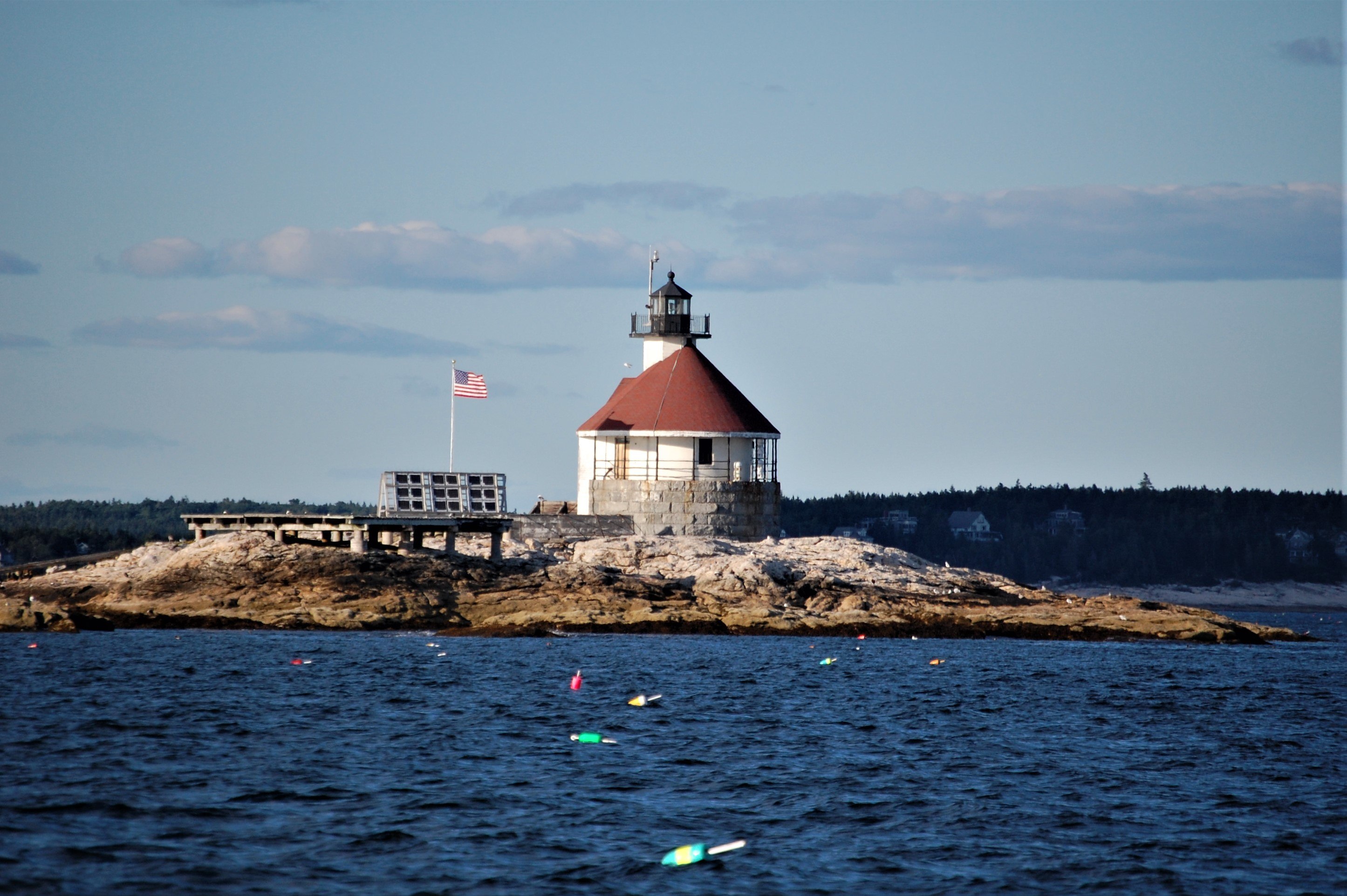
mitko / Northeast coast of US |
| Current status (active, not active, museum etc): |
Active |
| Construction details (year of built, shape etc): |
1907 |
| Height of the tower, m: |
48 |
Focal plane elevation above sea level, m: |
16 |
| Light Description (light sectors, colour of the light, number of flashes etc): |
Group flashing, 2 flashes per 6s, flash 1s, eclipse 1s, white |
| Range, nm: |
12 nm |
| Any other comments: |
Horn(1)15.00s. Fog signal is radio activated, during times of reduced visibility, turn marine radio to channel 83A. Key microphone 5 times consecutively, to activate fog signal for 45 minutes. |
| Coordinates (in any format): |
43.77965,-69.649968 |
| Displayed: |
8 times |
| Date added: |
Aug 13, 2020 |
| DateTime Original: |
2007:09:01 17:45:47 |
| Keywords: |
Maine ; United States ; Atlantic ocean |
| BBCode: |
|
| Download Link: |
Open picture in new window |
Use ctrl + scroll to zoom the map
Imagery ©2020 , Maine GeoLibrary, Maxar Technologies, USDA Farm Service Agency

|
from JC’s Naval, Maritime and Military News https://ift.tt/34BvEwL
via IFTTT
Discover more from JCs Royal New Zealand Navy Ships and New Zealand Defence, Also other World Defence Updates
Subscribe to get the latest posts sent to your email.