| File information |
| Album name: |
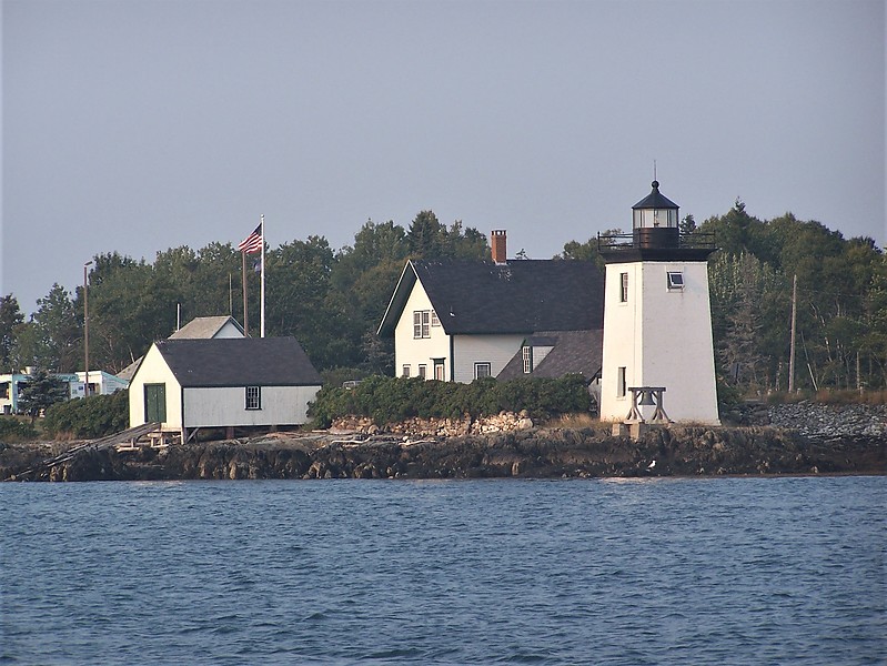
mitko / Northeast coast of US |
| Current status (active, not active, museum etc): |
Active |
| Focal plane elevation above sea level, m: |
11 |
| Light Description (light sectors, colour of the light, number of flashes etc): |
Flashing, 4s, flash 0.4s, eclipse 3.6s, white |
| Range, nm: |
4 nm |
| Coordinates (in any format): |
44 16.8841 N 68 56.5822 W |
| Displayed: |
6 times |
| Date added: |
Aug 18, 2020 |
| DateTime Original: |
2007:09:07 17:43:15 |
| Keywords: |
Maine ; Belfast ; Atlantic ocean ; United States |
| BBCode: |
|
| Download Link: |
Open picture in new window |
Use ctrl + scroll to zoom the map
Imagery ©2020 , Maine GeoLibrary, Maxar Technologies

|
https://ift.tt/2Ze8wkj
from JC’s Naval, Maritime and Military News https://ift.tt/334YJhO
via IFTTT
Discover more from JCs Royal New Zealand Navy Ships and New Zealand Defence, Also other World Defence Updates
Subscribe to get the latest posts sent to your email.